

Abstract
The global response to the COVID-19 pandemic has brought with it significant changes to human mobility patterns and working environments. We aimed to explore how social distancing measures affected recreational use of urban green space during the partial lockdown in Oslo, Norway. Mobile tracking data from thousands of recreationists were used to analyze high resolution spatio-temporal changes in activity. We estimated that outdoor recreational activity increased by 291% during lockdown relative to a 3 yr average for the same days. This increase was significantly greater than expected after adjusting for the prevailing weather and time of year and equates to approx. 86 000 extra activities per day over the municipality (population of 690 000). Both pedestrians (walking, running, hiking) and cyclists appeared to intensify activity on trails with higher greenviews and tree canopy cover, but with differences in response modulated by trail accessibility and social distancing preferences. The magnitude of increase was positively associated with trail remoteness, suggesting that green spaces facilitated social distancing and indirectly mitigated the spread of COVID-19. Finally, pedestrian activity increased in city parks, peri-urban forest, as well as protected areas, highlighting the importance of access to green open spaces that are interwoven within the built-up matrix. These findings shed new light on the value of urban nature as resilience infrastructure during a time of crisis. The current pandemic also reveals some important dilemmas we might face regarding green justice on the path towards urban planning for future sustainable cities.
Export citation and abstract BibTeX RIS

Original content from this work may be used under the terms of the Creative Commons Attribution 4.0 license. Any further distribution of this work must maintain attribution to the author(s) and the title of the work, journal citation and DOI.
1. Introduction
The 2020 novel coronavirus pandemic has caused unprecedented changes to mobility, economic activity and the associated environmental footprint (Muhammad et al 2020, Venter et al Venter, et al., 2020aa). This is because, during lockdowns, governments have enacted key policy measures to reduce the transmission of SAR-CoV-2 and protect public health. A primary measure has been the curtailing of transport and public mobility (Musselwhite et al 2020), resulting in half of the world's population under some form of confinement (Sanford 2020). In a few countries, including Norway, lockdowns have been less severe and citizens have been allowed to spend time outdoors while adhering to social distancing advisories.
This unique aspect of the Norwegian lockdowns raises the question of whether urban green space, including publicly accessible street trees, parks, natural vegetation and peri-urban forests, played a significant role in the way citizens adapted to the pandemic containment measures, perhaps spending more time recreating in green spaces. Researchers have already addressed the potential for urban nature to enhance resilience of urban populations during the pandemic (Samuelsson et al 2020) to provide an 'insurance value' by increasing resilience of cities (Gómez-Baggethun and Barton 2013). However there is little empirical evidence of the concepts of insurance value or resilience capacity, and specifically in the case of this paper, the conditions for absorbing large and abrupt changes in demand for recreational activity within green versus grey urban space, and the implications for public mental and physical health.
Recreational activity has substantial health benefits (Kahlmeier et al 2014). For example, walking has been shown to reduce the risk of cardiovascular disease by around 30% and all-cause mortality by 20% (Hamer and Chida 2008).In Norway, as elsewhere, citizens tend to ascribe great meaning and well-being to everyday walking in green environments such as parks and forests (Gundersen and Frivold 2008, Rybråten et al 2019). Numerous research studies have also shown that to recreate in green environments is more important for mental health benefits than recreation in urban grey areas (Fong et al 2018). Therefore, understanding the role of green space for recreational use is informative for any plans to achieve the sustainable development goals (SDG) 3 and 11 (good health and well-being; and sustainable and resilient cities). Furthermore, exploring the change in use of public space is important given that the COVID-19 pandemic is expected to bring about substantial changes to future design, use, and perceptions of public space (Honey-Roses et al 2020). In the planning of green spaces for urban resilience, equitable availability and accessibility also need further consideration (Jennings et al 2012, Suárez et al 2020).
We leveraged mobile tracking data and Google mobility data from thousands of individuals in the capital city of Oslo, Norway, to explore how COVID-19 containment measures affected recreational use of green spaces. The COVID-19 lockdown effect on recreational activity constituted a number of causal mechanisms which we did not have data to test. We characterise the lockdown effect as including (but not limited to) a reduction in cross-border travel, collective activities such as social events, schooling and work office attendance, and the associated change in daily schedules due to a shift in the parameters defining a work-life balance. In addition, during March 2020, Social Security statistics report an unemployment rate of 13.4% with 90% of these due to the COVID-19-related furlough (NAV 2020).
Considering the above, we hypothesised that (1) recreational use of green space increased during lockdown relative to a 3-yr baseline average (2017–2019) for the same days of the year. Secondly, we hypothesised that (2) the lockdown effect was significant after accounting for the potential confounding effect of local weather variations. Thirdly, we hypothesised that (3) lockdown-associated increases in recreational activity were greater over trail segments with greater tree cover and vegetation greenness values due to preferences for greenviews. Finally, we hypothesized that (4) increases in recreational use were greater on trails that are more remote because of social distancing advisories. The policy implication of these hypotheses is that accessible large open green space in combination with adherence to social distancing in the population mitigates the negative health effects of physical mobility restrictions, while reducing risk of disease transmission.
2. Methods and data
2.1. Study area
Oslo municipality is located in South-Eastern Norway on the Oslo Fjord (59'55 N, 10'45E) with a population of 693 491 which accounts for approximately 13% of the entire population of Norway (Statistikkbanken 2018). For purposes of analysis the study area is subdivided into several commonly used land cover/use classes (figure 1). The built zone (147 km2) includes virtually all the city's residents, commerce and industry, and contains 47% green space cover, with a minimum of 60 m2 of regulated green space (city parks in built zone figure 1) per inhabitant (Oslo kommune 2018). Oslo's street level greenview index is 28,8% (Treepedia; http://senseable.mit.edu/treepedia/cities/oslo). The built zone is surrounded by boreal conifer forest (frequently referred to as 'Marka') that covers 63% of the Oslo municipality area, and the Norwegian principle of common access (allemannsretten) grants anyone the right, within certain restrictions, to move freely across private and public uncultivated land (Outdoor Recreation Act, 1957). This area consists of a range of opportunities for recreation along an urban-wilderness continuum (Gundersen et al 2015).

Figure 1. Map of Oslo municipality study area. All available path/trail segments utilized by STRAVA users are colored by the majority land cover/use in which they are located. Base satellite imagery are provided by ©2020 TerraMetrics.
Download figure:
Standard image High-resolution imageRecreational infrastructure in the more urban end of the recreational spectrum consists of 1400 km of forest roads and 2100 km of marked trails (Oslo kommune 2018). Oslo followed national COVID-19 containment measures introduced on March 12th, including closing of kindergartens and schools, indoor fitness and sports facilities, all food, drink and cultural venues; advisories against travel to workplaces and use of public transport except for essential employment; prohibition of the use of second homes and cabins outside home municipality and advisories to confine recreation to home municipality; 2 m social distancing, group size limits of 5 people; and quarantine for all international arrivals and suspected infected individuals. Notably for the topic of this paper, indoor exercise facilities have been closed while people in quarantine have been allowed to recreate outdoors with no range limitation apart from staying within home municipality. The study period 12–31 March coincides with the period from when lockdown measures were announced to the peak in hospital intensive care admissions in Oslo (figure S1 (available online at stacks.iop.org/ERL/15/104075/mmedia)).
2.2. STRAVA data processing
STRAVA has a substantial user base in Norway with 175 000 individual runners and 95 000 individual cyclists recording a total of 5.2 million trips over the past year. We purchased pedestrian (walking/hiking/running) and ride (cycling) tracking data from STRAVA to assess recreational use within Oslo municipality between 2016 and 2020 (figure S2). Activity statistics are reported in hourly intervals per street/trail segment defined by an OpenStreetMap base layer. We used total activity counts per time interval regardless of direction of travel as a response variable in our analysis. The Oslo area contains over 7000 km of streets and trails utilized for recreation as detected by STRAVA user tracks (figure 1).
To maintain privacy and anonymity, STRAVA only registers an activity on a given trail segment if there are more than three users within a specified time period. Further, STRAVA users only reflect a sample of the total population engaged in recreational activity. Therefore by default one is limited to calculating relative changes in activity levels. To convert relative estimates into absolute activity numbers for Oslo municipality, we calibrated the STRAVA data using two established pedestrian and bicycle counters located at strategic points in the municipality. These counters (EcoCounter with two-way pyroelectric sensor) have been installed and managed for high counter accuracy following standard procedures (Andersen et al 2014). We first extracted activity data for the street/trail geometries that intersected the location of the established counters. We then performed a linear regression of monthly, weekly and daily counter totals on STRAVA activity counts (figure S3). The monthly and weekly regression coefficients were used to establish correction functions to estimate actual activity counts for all remaining trail segments over Oslo. Finally, we corrected for the positive long-term trend in STRAVA data associated with its growing user base by detrending the time series relative to the long-term annual average (figure S4).
While activity numbers per trail segment are useful for comparing location-specific trends in recreational use, they cannot be simply translated into city-level counts. To estimate the total count of recreational activity over Oslo municipality per time period (A), we used the function:
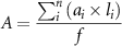
Where i is a single street segment, a is the calibrated activity count, l is the length of the segment in kilometers, and f is the activity constant. We defined f as the average distance traveled per recreational activity for pedestrian and cycling separately. Average distances were calculated from origin-destination data provided by STRAVA. These data are only made available as monthly aggregates and report total activity counts between unique pairs of origin-destination grid cells. Grid cells are defined by 350 m hexagons covering the study area. We calculated the average of the travel distance between origin-destination pairs to derive the activity constant f for pedestrian (4.4 km) and cycling (12.3 km) activity.
2.3. Google mobility and search data
To supplement and corroborate the STRAVA mobility data, we downloaded Google mobility trends over the lockdown period (https://www.google.com/covid19/mobility/). These anonymized data have been made public during the COVID-19 pandemic to support research and policy. They report percentage deviations in visits and length of stay at various places relative to a median day-of-month equivalent for January 2020. Secondly, we collected Google search query data from Google Trends (https://www.google.com/covid19/mobility/) to assess the change in search activity for keywords including forest ('Marka'), trip/hike ('tur') and outdoors ('utendørs'), as proxy indicators of outdoor recreation intention.
2.4. Identifying the COVID-19 effect
To identify the direct effect of COVID-19 mitigation actions on recreational activity, we measured the change in average activity during lockdown dates (12–31 March 2020) relative to the same dates during the previous three years (12–31 March 2017–2019). The 2017–2019 reference period is hereafter referred to as the baseline. We also calculated differences between lockdown and baseline activities during weekends and week days to assist in distinguishing between leisure and work commutes. The calibrated hourly recreational activity data were used to calculate these relative differences at both the street segment and the municipality level.
While comparing activity levels during lockdown dates relative to baseline averages along with discriminating week/weekend days accounts for the effect of weekends, annual holidays and sports events, it does not account for the potential confounding effect of abnormal weather variations—strong determinants of recreational activity. We used three years (2017 to 2020) of daily weather data to build a generalized linear model of daily recreational activity counts. Weather variables including temperature, rainfall amount, hours of sunshine, wind speed and snow depth were collected from five weather stations in the study area maintained by the Norwegian Meteorological Institute. We also included one-, two- and three-day lagged effects for weather variables, as well as the sin and cos component of the day-, week- and month-of-year variable to account for their cyclical nature. The model was trained on all data up until 12 March 2020 and was used to predict what recreational activity levels were expected to have been during 2020 lockdown dates (12 March onward) given the ambient weather conditions. Model 95% prediction confidence intervals were produced and used as benchmarks to assess whether the observed deviation in recreational activity was significantly higher or lower than would be expected given the weather and time of year.
2.5. Spatial covariates
To address our hypothesis that changes in recreational activity would be elevated in green spaces and specifically related to tree cover, vegetation greenness and trail remoteness, we collected a range of environmental covariates for each trail segment in the Oslo municipality. We performed Loess regressions (Jacoby 2000) of recreational activity changes on environmental covariates to explore non-linear responses. We also aggregated activity counts and changes within discrete spatial areas defined by land cover/use types that are meaningful to municipal decision makers (figure 1). Land-use/cover data were obtained from the City Environment Agency (Bymiljøetaten) and Statistics Norway (Statistikkbanken).
Tree cover was derived from digital surface (DSM) and terrain models (DTM) provided by the Norwegian Mapping Authority (https://hoydedata.no/LaserInnsyn/). DSM and DTMs are downloadable at 1 m spatial resolution and are calculated using light detection and ranging (LiDAR) remote sensing data. We calculated the canopy height model (CHM) by subtracting the DTM from DSM. The CHM represents the height of all surface objects above ground level. To isolate tree canopies from human-made surface objects, we used a dataset of all buildings within the municipality to exclude building footprints from the CHM. The remaining surface objects are predominantly trees, cars, movable containers or construction infrastructure. To exclude the remaining non-tree objects we masked out small (<3 m) and very large (>30 m) objects which are outside the typical height range of tree species found in Oslo.
We used the Google Earth Engine (GEE) cloud-computing platform (Gorelick et al 2017) to collect satellite-derived measures of vegetation greenness over Oslo. The normalized difference vegetation index, NDVI (Tucker 1979), was calculated from surface reflectance Sentinel-2 MultiSpectral Instrument data collected at 10 m resolution. NDVI is a widely-used proxy for vegetation vigour and productivity. We calculated the median NDVI from all available Sentinel scenes intersecting Oslo during 2018 and 2019 summer months (June–August) to mitigate cloud and snow contamination. Images have been orthorectified and atmospherically corrected before ingestion into GEE, however we applied a further processing step to filter out cloudy pixels using the 'QA60' band. The average tree cover and NDVI was calculated over all pixels within 10 m of each recreational trail segment.
To capture the spatial diffusion/concentration of activity, we constructed indicators of trail remoteness as both the population density and the recreational trail coverage (i.e. density) within 500 m of each trail segment. Gridded population density data were downloaded at 250 m resolution from Statistics Norway (Statistikkbanken 2018). Recreational trail cover was calculated from the total STRAVA trail network (all OpenStreetMap trails utilized by STRAVA users). All line segments were buffered by 10 m and the total surface area of neighboring trails within 500 m of each trail segment was calculated.
3. Results and discussion
3.1. Recreational activity increase
Outdoor recreational activity over Oslo municipality increased by 291% during 2020 lockdown dates (13 March onward) relative to the 3-yr baseline average (figure 2). In absolute terms, the number of unique daily recreational activities increased from 28 000 to 114 000 (86 000 increase). Furthermore, the total increases in lockdown activity were greater for cycling relative to pedestrian activity categories (324 vs 259% increase; figure 2).

Figure 2. Recreational activity time series. Daily pedestrian (run, walk, hike) and cycling (bike) recreational activities recorded in Oslo before and after the coronavirus lockdown on 13 March (dashed red line). The 2020 time series (purple) is plotted in parallel to the time series for the same dates averaged over a 3-yr baseline (green). Benchmark activity levels expected given the local weather and time of year are plotted in black with 95% confidence interval bands. Inset boxplots show the spread of daily activity counts for baseline, weather benchmark and 2020 post-lockdown dates.
Download figure:
Standard image High-resolution imageThe observed increases might have been confounded by differing weather patterns during 2020 relative to previous years, however in reality the differences were negligible (0.8 mm less precipitation, 3 min less daily sunshine, 1.2 °C warmer temperatures and 1.2 m s−1 faster wind; figure S9). Nevertheless, we applied a weather benchmark model and found that observed increases in activity were higher than we would have expected given the prevailing weather conditions during lockdown. Specifically, activity counts were significantly higher than the weather benchmark model predicted for pedestrian and cycling activities on 13 and 10 d of the two week post-lockdown period, respectively (figure 2). This may reflect the avoidance of public transport during lockdown where recreationists preferred to cycle to hiking locations. Part of the effect in cycling may also be due to public transport commute being replaced by cycle commute, although this effect is small due to advisories to work from home (figure S7).
These aggregate increases in recreational activity are corroborated by aggregated Google mobility data showing a 19% increase in visits to parks and green spaces (figure S5). At the same time, Google searches originating in Oslo that included Norwegian words for forest ('Marka'), trip/hike ('tur') and outdoors ('utendørs') all increased substantially during lockdown dates, indicating increased recreation intent (figure S6). We interpret these observations as an immediate response to the possibilities for doing outdoor recreation and at the same time comply with lockdown restrictions in Oslo municipality. During lockdown indoor training facilities have been closed with 10% of members cancelling their membership during the first two weeks of the lockdown (E24 2020). Therefore access to open space for dispersed use in attractive environments functioned as a substitute and refuge for a large part of the population during the COVID-19 situation.
There was a notable shift in the diurnal pattern of recreational activity during lockdown. Activities were more evenly spread over the duration of daylight hours instead of following a bimodal morning-evening peak typical of pre-lockdown activity (figure S7). This change was more stark for cycling relative to pedestrian activity, possibly reflecting the reduction in work-related morning cycling commutes and the increase in daytime leisure cycling activity typical during weekends. Walking and cycling are flexible daylight activities and it seems that people adapted to the COVID-19 situation by spreading their activity over time in densely populated areas.
In contrast to the shift in diurnal activity patterns, the shift in weekday vs weekend activity was less start. Increases in activity were greater on weekends (334%) relative to week days (249%; figure 2). Given the rise in unemployment (NAV 2020), and that a major segment of the population were granted more flexible home-work schedules, one might have expected greater increases in weekday recreational activities. However, this was not the case, suggesting that there were other variables mediating the decision of when to recreate. As more data emerges quantifying the nature of lifestyle change under COVID-19 lockdowns in Oslo, deciphering the causal drivers of recreational changes may be possible.
3.2. Spatial pattern of activity changes
The changes in recreational activity during lockdown were not homogenous over the city (figures 3 and 4). This pattern was consistent even when considering lockdown differences relative to the two weeks directly preceding lockdown (figure S8). Activities were intensified in the urban periphery, while marginal increases and, in some areas, decreases were evident toward the city center for both pedestrian and cycling activities. This is not surprising given the advisories for home-office work which reduced inner-city cycling and running commutes. At the same time there is much more space to adhere to social distancing guidelines in the peri-urban areas, where there is easy access to walkways, bikeways, forest roads, as well as marked and unmarked trails. Furthermore, while proximity to urban green space seems to determine how active people are during work-days (Gundersen et al 2016), distance might represent a smaller barrier on weekends (Bertram et al 2017). This weekly rhythm has been largely interrupted during lockdown, and this can perhaps also account for some of the observed variations between the urban periphery and center.

Figure 3. Spatial variation in recreational activity change. Average daily activity counts per trail segment over Oslo during 2020 March lockdown dates compared to the average for the same dates during a 3-yr baseline period (2017–2019). The activity differences (Δ activities day−1) between the two periods are mapped on the right. Base satellite imagery are provided by ©2020 TerraMetrics.
Download figure:
Standard image High-resolution image
Figure 4. Recreational activity changes by land use/cover zone. The magnitude of change in total activity counts between lockdown dates ('Lockdown') and the average for same dates over the baseline period (2017–2019, 'Baseline') are plotted with points and line segments for major municipal land cover/use classes. Vertical lines indicate 95% confidence intervals. Plots are arranged by the magnitude of change, decreasing from left to right.
Download figure:
Standard image High-resolution imageThe greatest increases were observed in the peri-urban 'Marka' forest area (see figure 1 for reference), while smaller relative increases were evident in the coastal zone, commercial and agricultural areas (figure 4). While cycling activity increased with similar magnitudes across all land cover classes, pedestrian activity increases were greater in green spaces including forest and city parks compared to other city spaces (figure 4). This is also evident in the variation in recreational use intensity across vegetation greenness and tree cover gradients (figure 5). Lockdown pedestrian activities showed deviations from the baseline, increasing as a function of higher tree canopy cover and greenviews. Cyclists appeared to intensify activity on trails with greenness in a range of 0.2 < NDVI < 0.6, relative to a baseline preference for less green cover. This probably reflects the shift from work-related commutes to centralised office locations to recreational cycling outside the more densely built city center. Cycling does not show the incremental response to greenness and canopy cover shown by pedestrians. This might be because cyclists typically travel at greater speeds with more focused attention to the trail compared to pedestrians' slower speed, non-linear travel and higher ability to satisfy visual sensing of their surroundings (Edensor 2000, Rybråten et al 2019). This could explain differences in pedestrian and cyclist use of greener trails in our data. Pedestrian and cycling use appear to peak and drop off at high thresholds of green cover density, possibly reflecting the ease of movement through denser vegetation. Cyclists may find it more challenging to cycle through dense vegetation (high NDVI) or dense forest with narrower trails. Pedestrians on the other hand, are not limited by increased tree canopy cover, but only by the density of vegetation associated with high NDVI values.

Figure 5. Trail greenery vs recreational activity change. Loess regression lines plotted for relationships between daily activity counts and two measures of trail greenery extracted for every trail segment over the city (n = 131 716). Separate lines are plotted for March lockdown dates (13–31) and a baseline period (average of lockdown date-equivalents 2017–2019).
Download figure:
Standard image High-resolution imageDuring the lockdown period, recreational use intensified within residential areas and city parks nearly as much as in the forested zone (figure 4), highlighting the value and importance of inner-city green spaces that are interwoven with the built-up city matrix. We know from previous research that closeness to urban nature has a particularly strong impact on the level of physical activity among children, the elderly, and other persons with reduced mobility (Shin et al 2011, Kemperman and Timmermans 2014). Therefore we are cautious about highlighting the beneficial effect of access to Oslo's surrounding forests for the population as a whole given that small green spaces within the city may be of crucial importance to some social groups. Indeed, Oslo's residential areas contain large amounts of tree cover which provide recreational ecosystem services (Gómez-Baggethun and Barton 2013, Venter et al 2020b). We found that there was a two-fold increase in both pedestrian and cycling activities on city trails with >75% tree canopy cover (figure 5). This is in line with other studies that show how recreation in green spaces has significant benefits for mental health (Rasmussen and Laumann 2013, Cox et al 2017, Fong et al 2018, Bratman et al 2019).
We also find evidence that the government advisories for social distancing were considered, given that recreationists appeared to choose trails that were more isolated (figure 6). Specifically, trails with fewer neighboring trails and lower population densities within 500 m had greater daily pedestrian and cycling activity counts relative to the baseline state. This highlights the importance of maintaining large, open green spaces that are accessible from built-up residential areas with vegetation that facilitates an experience of remoteness that is also congruent with advisories for social distancing and even self-isolation. By facilitating social distancing, we argue that open, accessible and unmanaged green space in the urban periphery of Oslo provides additional resilience to the city's public health during the coronavirus pandemic. Indeed, there is evidence that denser cities exhibit higher COVID-19 infection rates (Stier et al 2020), suggesting that green infrastructure networks which increase the openness and porosity of a city structure may produce future cities thatare more resilient to viral pandemics.

Figure 6. Trail remoteness vs recreational activity change. Loess regression lines plotted for relationships between daily activity counts and two measures of trail remoteness extracted for every STRAVA trail segment over the city (n = 131 716). Separate lines are plotted for March lockdown dates (13–31) and a baseline period (average of lockdown date-equivalents 2017–2019).
Download figure:
Standard image High-resolution image
3.3. Study limitations
There are several assumptions implicit in our analysis that could not be avoided given the data available to us. Firstly, our analysis assumes that STRAVA adoption is relatively homogenous over the city of Oslo. However, it is possible that STRAVA has biases along socio-economic gradients, e.g. higher adoption rates in high income neighborhoods (Griffin and Jiao 2015), and therefore results in a bias in the spatial distribution of activity counts. As a result of the spatial bias we may be missing data on how low-income and marginal groups utilized green space during the lockdown. The strength in our study is, however, that we measure relative activity differences over time and we might assume that the same biases occur during lockdown and in the baseline period. We were only able to leverage two fixed-point counter stations for calibration back to 2016, and future efforts would benefit from stratifying counter stations across the city so as to correct for spatial biases in STRAVA data.
Secondly, our interpretations on relative differences in cycling vs pedestrian activities relies on the assumption that STRAVA mobile application is adopted in equal proportions across the cycling and pedestrian recreational communities in Oslo. While this assumption is likely valid, further work is required to calibrate relative differences between activity categories. Our ground-truth reference counters do not distinguish between cyclists and pedestrians and thus we were not able to do this. Nevertheless, our calibration of the STRAVA activity counts using fixed-point counter station estimates revealed a strong overall correlation (R2 = 0.8; figure S2). This is comparable with the correlations found with STRAVA data in the UK (Sun et al 2017), USA (Griffin and Jiao 2015, Hochmair et al 2019) and Australia (Conrow et al 2018, Norman et al 2019).
3.4. Broader implications
The findings from our study may be extended to relating mobility changes to enhanced ecosystem service delivery. For instance, accounting for the benefit of green space for mental health highlights the urgent need to mitigate the mental health burden under the pandemic conditions (Holmes et al 2020). High resolution spatial and temporal recreation use data make it possible for urban ecosystem accounts to identify the links between ecosystem service demand (recreational use intensity), supply (accessible open green space), ecosystem urban condition (vegetation density and canopy cover) and final benefits (public health, well-being) (Barton et al 2019). Assessing this data during the extreme natural experiment caused by COVID-19, research can provide policy-makers and planners with powerful additional evidence supporting the conservation of existing green space and the allocation of scarce urban land to new open green spaces that promote physical exercise and mobility. For example, redesigning streets and public areas to free up space for pedestrians and recreationists may address several public health objectives (Honey-Roses et al 2020).
A further policy implication of our findings for mobility advisories during the COVID-19 pandemic is that accessible open green space in combination with population adherence to social distancing can mitigate the predicted negative health effects of moderate physical mobility restrictions, while reducing risk of disease transmission. Of course, Oslo's abundant green space and relatively relaxed lockdown measures stand in contrast to other European cities where green space is limited or where citizens have been confined to their homes (Barton 2020). Despite this, it is evident that urban green space provides a refuge service during the ongoing pandemic over the short-term, but also enhances long-term resilience against similar shocks in the future (Samuelsson et al 2020).
Importantly, the COVID-19 pandemic has shed light on what some aspects of everyday urban life might look like in a more sustainable future: With higher residential density and reduced long distance traveling the need for local recreational opportunities will increase the pressure on urban green spaces (Russo and Cirella 2018). Our observations during the 2020 lockdown in Oslo indicate that there is at least capacity for a 200%–300% increase in recreational activity, however it is unknown whether green spaces will become overcrowded and therefore reduce the beneficial health effects (Akpinar 2016). Further, designing potential solutions will require knowledge about the social mechanisms behind the observable recreational patterns as well as the managerial conditions for taking green space into account in policy-making and planning processes. Important questions of green justice relate to the social distribution of access to green space, both in and between neighborhoods, as well as the interaction between different social groups in urban green spaces (Venter et al 2020c). Research from other large cities suggests for instance that a political prioritizing of collective sports and football fields over more 'natural' green spaces may lead to better recreational opportunities for some groups at the expense of others (Wendel et al 2012, King et al 2015). In demographically and culturally mixed cities like Oslo, the social resilience effects of urban green space depends on whether the design and management of green infrastructure is able to facilitate a variety of recreational and leisure activities. To acknowledge urban green space not only as a health buffer, but equally as a place where conflicts of interests occur suggests further investigation into how citizens are represented and involved in local planning; and not least identifying who maintains the power to decide what happens to the local urban green space.
4. Conclusions
We find evidence to support the hypothesis that recreational activity significantly increased during the COVID-19 lockdown in Oslo and that increases were greatest over trails within greener and more remote areas. The ecosystem services derived from urban green infrastructure are well-known. However, empirical data on urban ecosystems often deals with incremental change in urban development. Outside of simulation models, it is not possible to demonstrate the impact of systemic shifts in urban design on inhabitants. The shock of COVID-19 mobility restrictions and the public's immediate reaction to them is an extreme natural experiment that for a limited time opens a window on the importance of green space for urban resilience design. We suspect that green spaces acted as a substitute for prohibited indoor fitness and sport activities, and a refuge from stress during the COVID-19 lockdown, and might have even mitigated the spread of the virus by facilitating social distancing, although this requires further investigation. Our study also illustrates the utility of crowdsourced activity tracking data for monitoring changes in use of green space that can potentially inform urban ecosystem accounting and planning policies for nature-based solutions that address SDG.
Acknowledgments
The research was carried out with support of the URBAN EEA project—Experimental Ecosystem Accounting for Greater Oslo (URBAN EEA), MILJØFORSK programme, The Research Council of Norway, contract #255156 (ZSV, MN) and URBAN SIS (Strategisk Instituttsatsing), Norges Forskningsråd (prosjekt no. 160022/F40) (DNB, VG). We want to thank Norwegian nature surveillance for access to counting data.
Data availability statement
The data that support the findings of this study are available upon reasonable request from the authors.