Walkers, cyclists and horse riders
Almost 40 miles of new or improved pathways proposed by the Lower Thames Crossing
National Highways is one of the biggest builders of pathways in the UK and the Lower Thames Crossing will add or improve almost 40 miles in total - 3 miles for every 1 mile of new road.
These new or improved pathways are designed to encourage active travel and promote health and wellbeing across the region.
Our plans include new or improved bridges and pathways for walkers, cyclists and horse riders, to encourage active travel between parks, woodlands, heritage sites and employment centres in Kent, Thurrock, Brentwood and Havering.
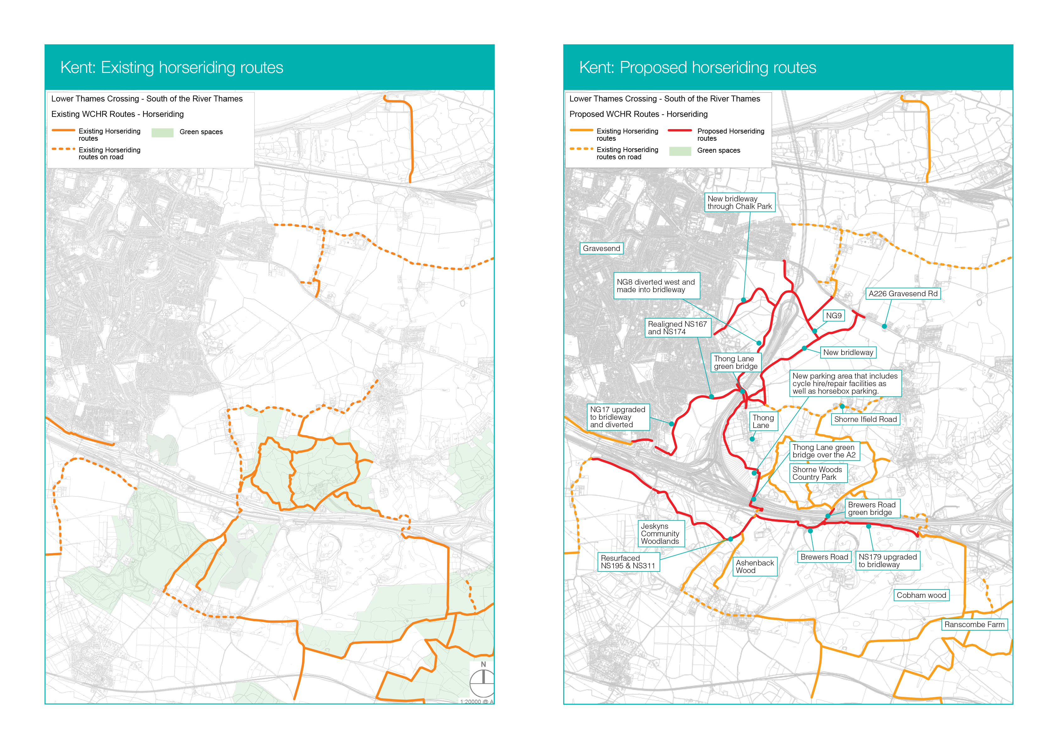
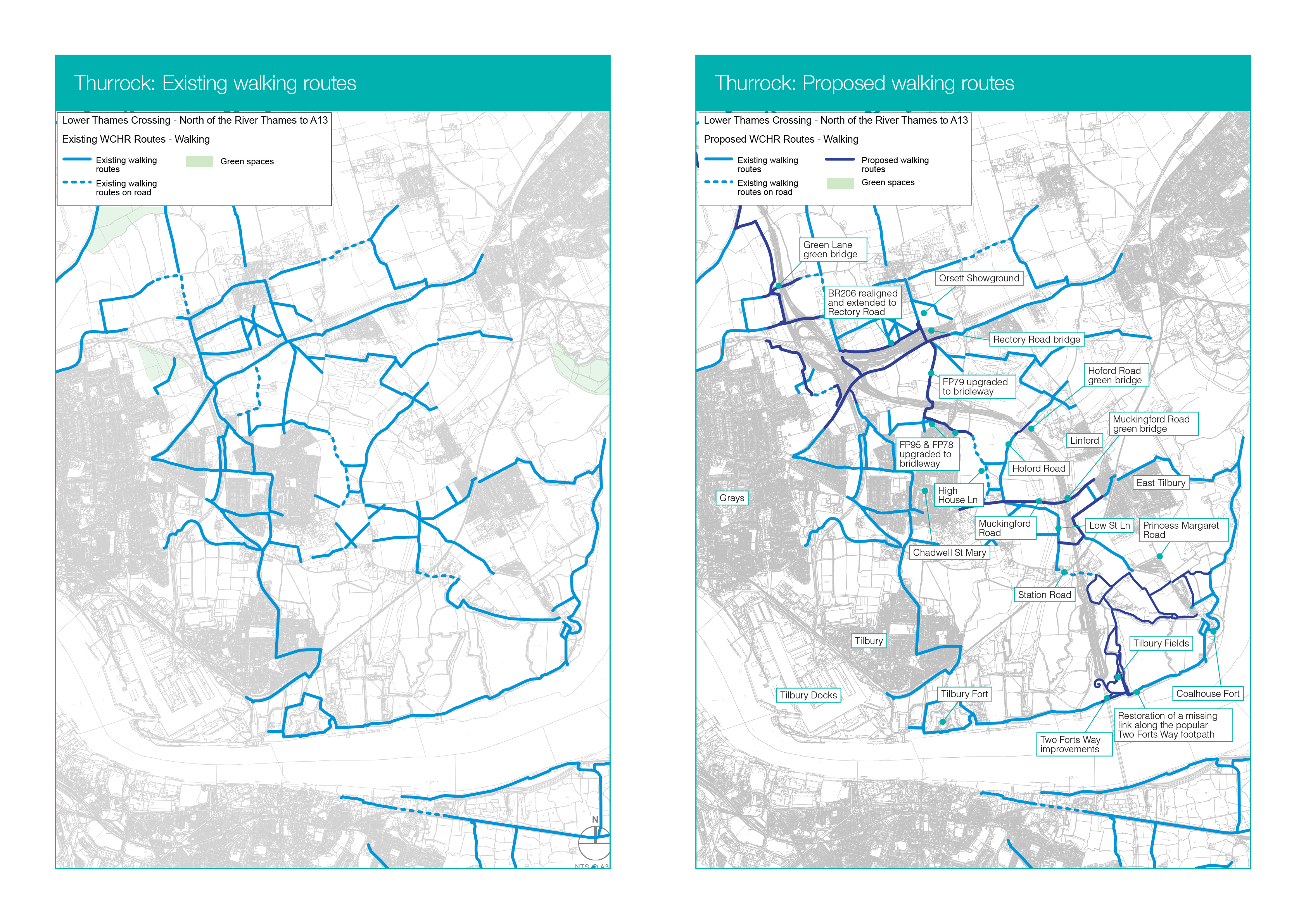
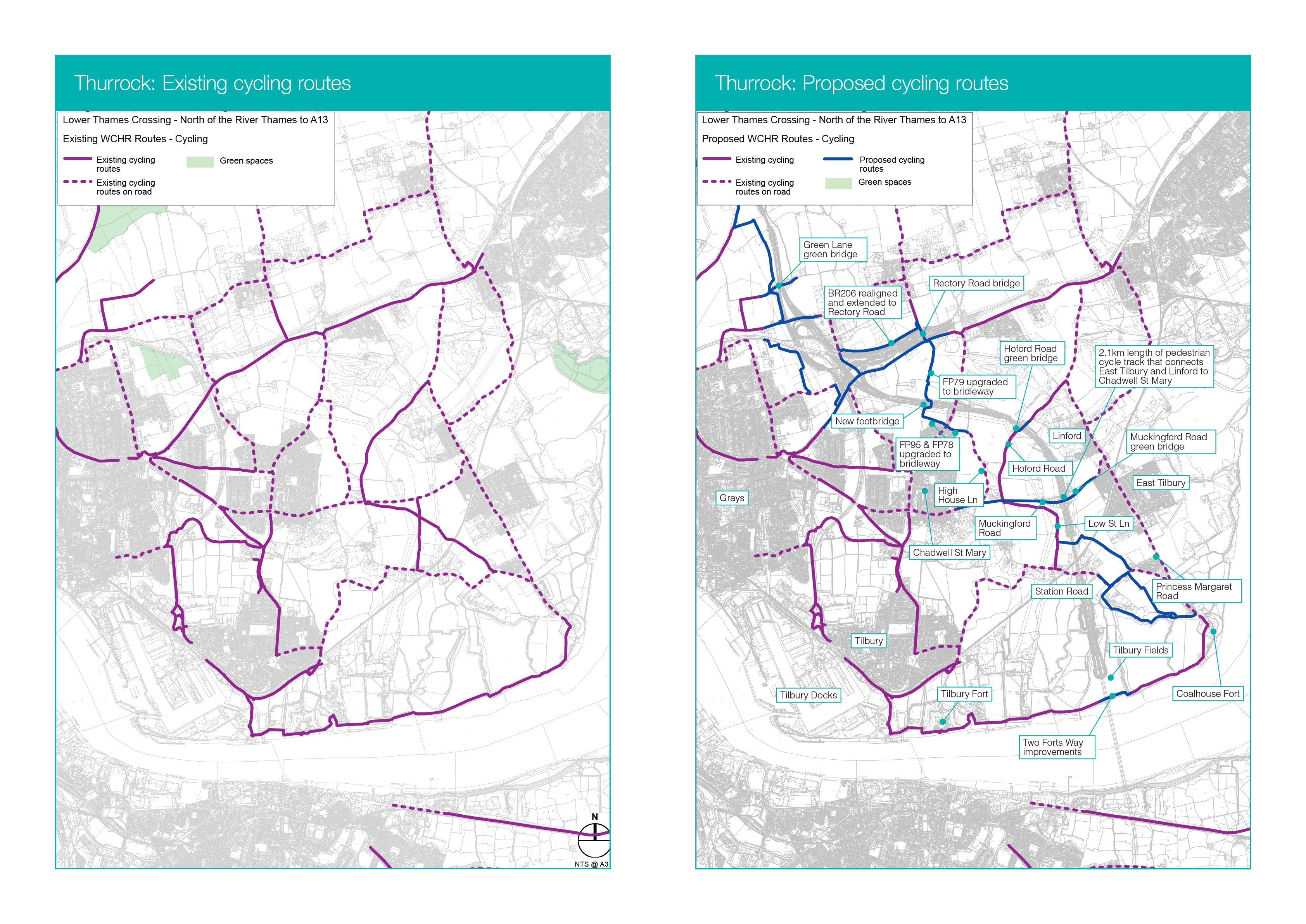
Open our illustrated map to see what new journeys are available to you, and explore our detailed route maps that show the existing and proposed paths in detail.

Our plans include:
- Seven new green bridges - provide safe and easy crossings for people and wildlife, including an 84m wide bridge in Kent, one of the widest green bridges in Europe
- New footbridges - two over the A127 and one over the M25 to create safe, easy crossing points and restore links severed by historic road building
- A network of bridleways - giving horse riders an uninterrupted route between woodlands such as Thames Chase Forest, Hole Farm community woodland and the Mardyke in Essex, and Ranscombe Farm Reserve, Ashenbank Wood and Shorne Woods Country Park in Kent
- A new cycle route - south of the A2 running through Jeskyns Community Woodland from Park Pale in the east to Hares bridge in the west
- A new 1.8-mile foot and cycle path - separated from road traffic, will provide a safer and easier way to commute between East Tilbury, Linford and Chadwell St Mary.
- Improved foot and cycle path - between the local community and heritage sites such as Coalhouse fort and East Tilbury Battery
Some of the changes have been proposed following feedback received during our consultation in 2021. You will have the opportunity to give feedback on these and other changes in a consultation being planned later in the spring. Sign up to our newsletters.
Watch videos
See detailed maps to view the existing and proposed routes in your area:
See artist impressions of the new paths:
Artist impression of the Thames Chase Community Forest bridge
Artist impression of the new Rectory Road bridge
Artist impression of the Thong Lane green bridge
Artists impression of repaired Two Forts Way foot and cycle path and Tilbury Fields park in Thurrock
Artists impression redirected NCR177 cycle path in Kent
Artists impression of Muckingford Road looking west with segregated cycle and foot path
Artists impression of new footbridge over A127 west of M25
